Sea ice thickness
Sea ice thickness from satellite radar altimeter and passive microwave data
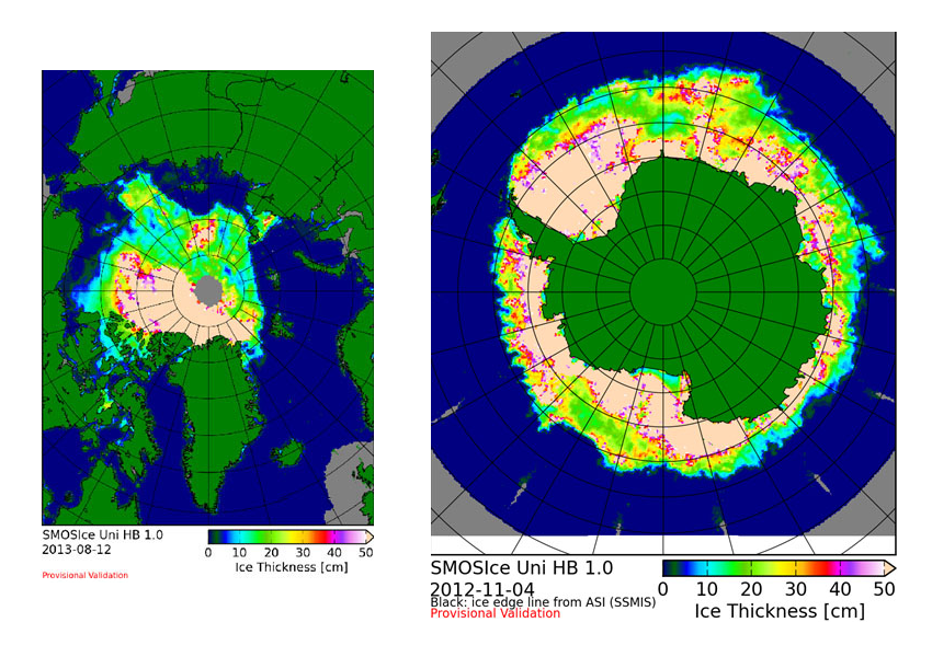
The L-band radiometer on SMOS (Soil Moisture and Ocean Salinity), launched in 2009 has demonstrated capability to derived sea-ice thickness up to values of about 0.5 m. These ice thickness maps show how thin ice grows from the beginning of freezing season to mid-winter. Retrieval algorithms have been developed into an operational service, providing ice thickness maps for both Arctic and Antarctic (Figure 1). Ice thickness from SMOS is complementary to ice freeboard data from altimeters, which mainly can be used to estimate thickness above 1m. More information is available at https://wiki.zmaw.de/ifm/SMOSIce.

Figure 1:
Sea ice thickness derived from SMOS data. Left: Arctic sea ice thickness from SMOS, 21 August 2008. Right: Antarctic sea ice thickness from SMOS, 4 November 2012.
©UB
